


Today is a day to be weather aware, with strong to severe thunderstorms, damaging winds, tornadoes and hail possible. Storms will also bring prolonged heavy rainfall which could lead to flash flooding. A wind advisory has been issued.
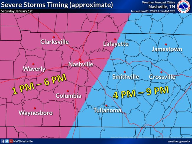
In our area, the National Weather Service is advising the timeline for severe storms to be from 1-6 p.m.
Overnight, a tornado warning for Henry and Weakley Counties was issued.
Today, much higher than normal temperatures will be felt, up to 70 degrees and overnight tonight, temperatures will be much colder.
Much colder air will filter into the region behind a cold front Saturday Night. An upper level disturbance will then move into the Mid-South by Sunday morning. Chances for snow will occur with the disturbance. No accumulation is expected.
Wind chill values will drop into the teens Sunday and Sunday Night.