


The following from Obion County EMA Director Danny Jowers:
After a lengthy and detailed discussion with NWS Memphis, the general consensus is as that our area including Obion County, starting Saturday, will see excessive rainfall in a short time period. Amounts will range from 4 to 6 inches with some isolated areas more than 8 inches. With the rivers already at flood warning stages, and the ground saturated, areas that in the past have been proned to flash flooding should be on high alert. The following is what we can expect over the next 5 days.
TORNADO WATCH southern part of Obion County. slight risk
Flash Flood watches and warnings. HIGH Probability
Winter Weather Watches and Warnings Wednesday 50%
Severe Wind Chill warnings Thursday and Friday HIGH
So as you can see anything and everything is possible.
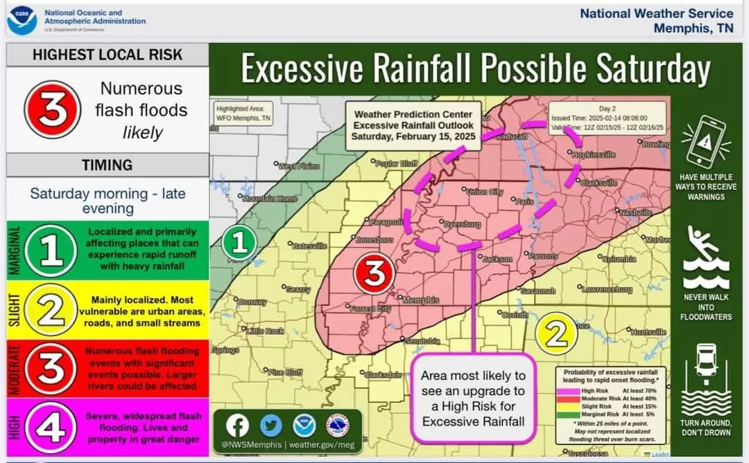
Included is a graphic from NWS with their prediction. Take note of the purple dotted line that they call the bullseye.
Take note prepare and by all means turn around don’t drown.